Valle Verzasca
landscape heaven
This article was first published in OnLandscape in November 2015 (Issue 102). Since OnLandscape is a (very worthwhile and value for money) pay site, it wasn’t available for general view. Well, now, with a few modifications, it is.
The geography of Switzerland is dominated by the East-West high alpine ridges that split the country into Northern and Southern parts. The Northern part is where the major cities and industrial centres are located. The Alps themselves are the home of spectacular highlights like the Eiger, the Matterhorn, or the Aletsch Glacier. But the Southern side is a little less well known, and has a quite distinct character. South of the Rhone Valley and the Gotthard massif lies the Italian-speaking Canton of Ticino. And while Ticino certainly has it’s fair share of tall peaks, the highlights, geographically speaking, are to be found in and around a series of glacial valleys descending from the high snowfields, with tumbling rivers feeding into the Maggiore Lake. Any one of these valleys, including the Maggia, Calanca, and the Centovalli, would keep most landscape photographers busy for years, but the jewel in the crown, and the subject of this article, is the Valle Verzasca, through which the river of the same name runs.
The Verzasca valley is around 25km long, stretching due south down from the village of Sonogno, through an endless sequence of cascades, rapids and gullies until it reaches the artificial Lake Vogorno. This is created by a spectacular dam, the Diga di Contra, which was the scene for the opening sequence of the James Bond film Goldeneye, and today is famous for its terrifying bungee jump. Having passed the dam, the river threads its way in a more leisurely fashion before emptying into Lake Maggiore, a few km away from the city of Locarno.
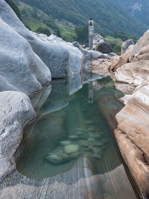
I defy any landscape photographer with a pulse to get further than a third of the way up the valley without demanding to stop. Even if the temptations of the artificial lake can be resisted, with the clusters of old town houses clinging to one steep side, and the emerald green waters of the lake lapping up against the forests that plunge down to the other side, once you pass the church at Berzona (carefully!) and enter the upper valley, the scenes that unfold are irresistible.
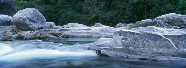
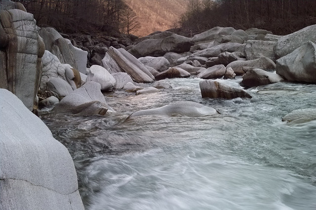
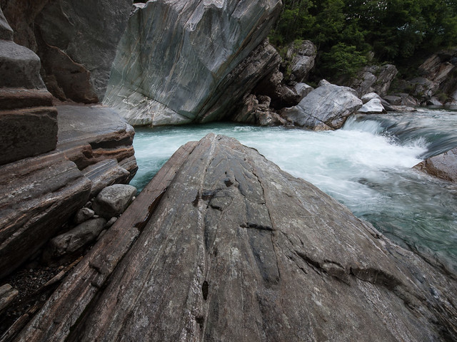
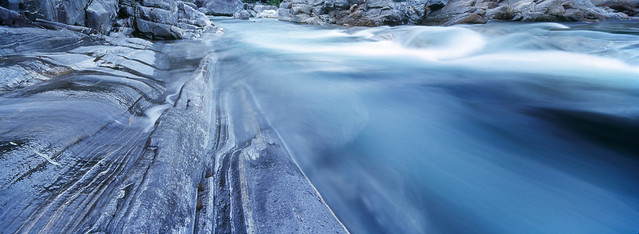
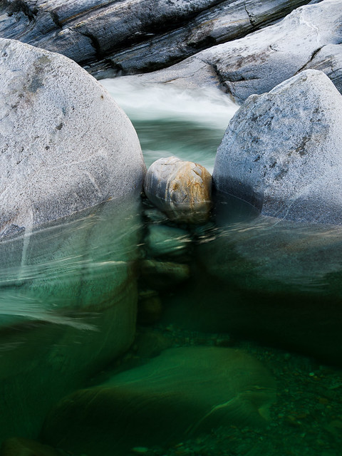
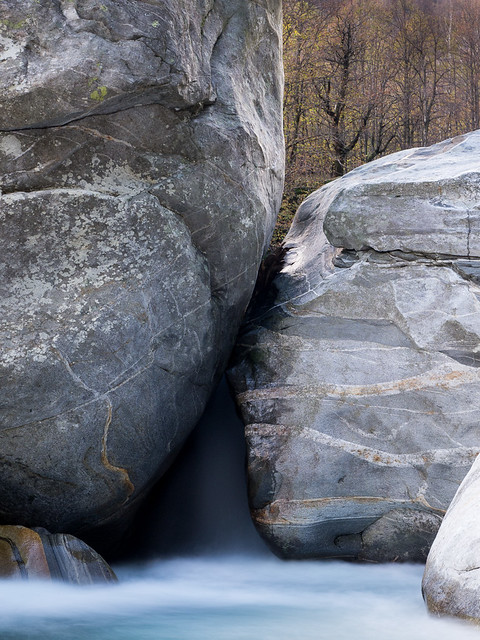
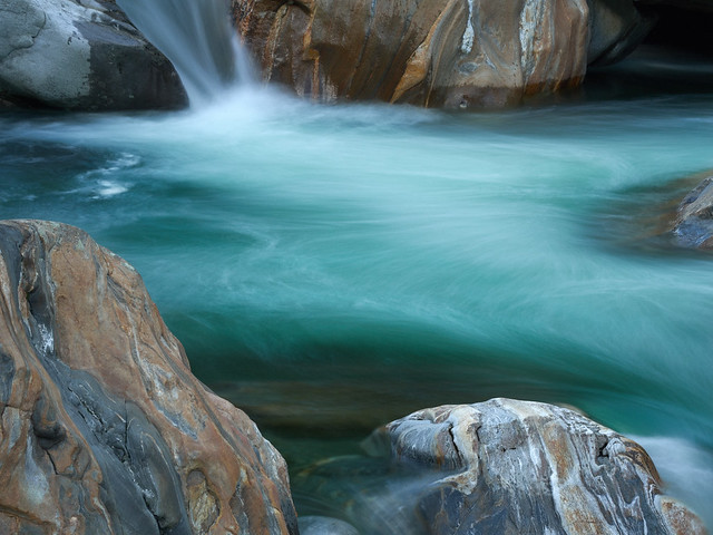
The bedrock of the Verzasca river is mainly gneiss, and over the millennia this has been eroded by the current to reveal fantastic banding and layering patterns in the rock, which in turn has been sculpted into spectacular forms. Add to this the transparent dark green and emerald waters, a sprinkling of reflected light from the surrounding forests, and any one location could keep you busy for a week. And there are countless such locations. I am fortunate enough to live close enough to the valley to visit pretty much on a whim, and have been doing so for 15 years, but even so, on each visit I discover somewhere or something new.
The nature of the landscape suits it to a variety of styles, from wide angle vistas all the way down to very intimate details. For some reason, very little has turned up the way of photographic publications from the area, but one book I have found, Pietre in valle Verzasca, by Mario De Biasi, concentrates mainly on detail studies of small scale rock patterns and formations. You can embrace, or leave out, the water. You can feature the surrounding chestnut forests, especially in Autumn, or crop them out. You can pick a short stretch of the river and get to know how all the little details of the flow change with the seasons and the water level. The water level is very variable, and this often leads to certain compositions being quite unrepeatable.
After Berzona the valley contracts very noticeably, and you start to get glimpses of the river. You can also see the village of Corippo, the smallest municipality in Switzerland, clinging precariously to the opposite slope. Corippo is well worth a visit: the whole village is protected as a Swiss Heritage Site, and remains largely untouched. It was not even accessible by road until the end of the 19th century.
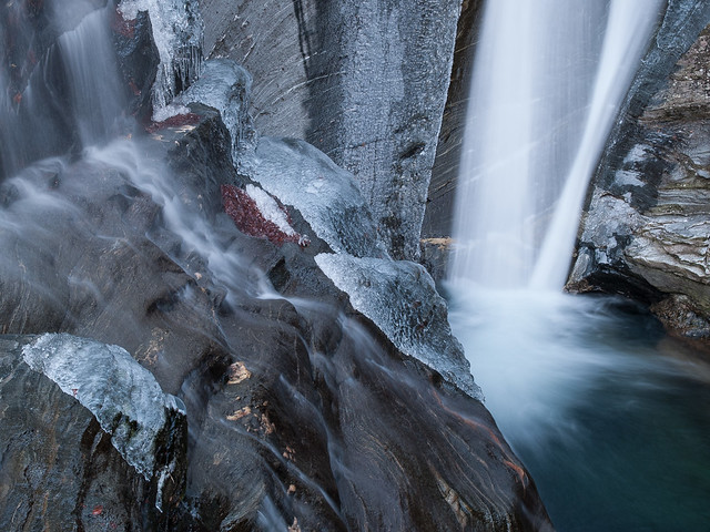
Some of my favourite haunts are found soon after the Corippo crossroads. This part of the river is dynamic and fast moving, and it’s well worth taking a little time to discover paths down to the rocks. A word of warning, though, which applies to the whole valley: be very careful, the rocks are very slippery when wet, and are prone to accumulate black ice the winter. You do not want to fall into that river, even in the summer. It has very strong currents and is very cold. And, sadly, it claims victims every year. Take your time, don’t go down in the gorge alone, and don’t take unnecessary risks. The water level can also change frighteningly quickly, and it is all too easy to get trapped. Since Switzerland is not much of a nanny state, and assumes you can take care of yourself, you won’t find many handrails, but there are an increasing number of warning notices in the parking areas.
Up until now I’ve managed to completely avoid any mention of the number one attraction of the valley, the village of Lavertezzo. Let’s be clear, you’d probably be best advised to avoid Lavertezzo in the summer, unless of course your photography extends to a more Martin Parr-like style. Lavertezzo is totally gorgeous, but it is completely overrun in summer, even to the extent that large tour busses manage to get there (totally insane in my opinion, and I’ve seen some stuck in the narrow, tight hairpins at the mouth of the valley more than once). However, should you find it at a quiet moment, you’ll find it hard to ignore. The village itself is pretty, but the main attraction is the area just below it, where the river has cut channels of all shapes and sizes through a wide platform uplifted gneiss. Overlooking this is a high, narrow twin arched stone bridge dating from the 17th Century. I described Lavertezzo in a little more detail in an article I wrote back in 2009.
The human history of Valle Verzasca has, up until the mid–20th Century, been one largely of poverty and subsistence farming. Being a closed valley, it generally attracted less attention from invaders than surrounding regions, and was something of a safe haven. It came under the control, variously, of the Swiss Confederation and various Northern Italian kingdoms, but was always heavily under dominion of the Catholic church. It was also pretty much uninhabitable in the winter, and then the population moved down to the Magadino plain, along with their livestock. Some reminder of this is still evident in place names today, for example you will find the village of Lavertezzo Piano near the foot of the Verzasca, to where the population of Lavertezzo retreated from the snows.
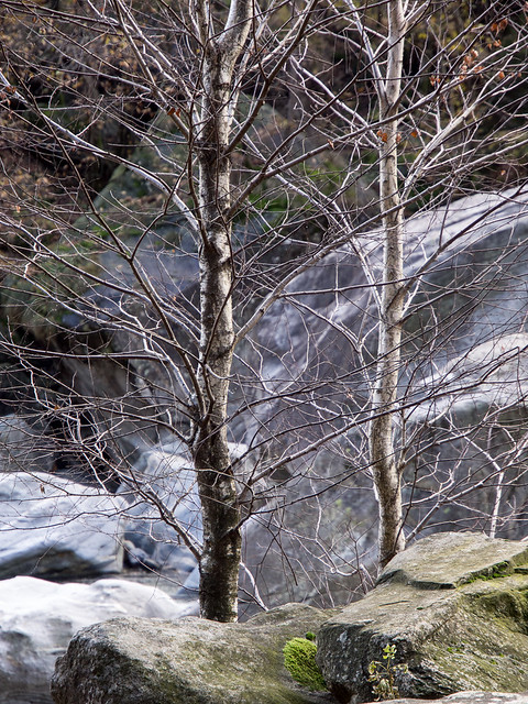
The forests surrounding the valley have a large proportion of chestnut trees. These were actually planted in the Middle Ages, and provided a critical contribution to the people’s diet. Chestnut flour is still a treasured traditional ingredient in Ticino. However, a blight leading to failed crops bought famine in the late 19th century, leading to mass immigration from the valley, and other surrounding areas, to North and South America, and to Australia. The museum at Sonogno, as well as the one at Cevio in Vallemaggia, document this period. The result was a massive crash in the population, which was far higher than today. If you follow the mountain paths from any of the villages, you quite often come across the ruins of long-abandoned hamlets invaded by the forests. It can be quite moving to sit and imagine the lives of the long-gone inhabitants of these forgotten villages. And of course, there lies another whole world of photographic opportunity.
Upstream of Lavertezzo the river widens, and rushes over a series of rapids. This area is more interesting for the colours of the larch forests in Autumn, and for a number of quite spectacular waterfalls on the west side of the valley. But the next part is perhaps the richest of all from a photographic perspective. Below the village of Brione, the river drops about 50m over a couple of kilometres, threading its way through a field of huge boulders. You see the end of this stretch where the road crosses the river, about 5km from Lavertezzo. The east bank of this stretch is accessible from a footpath which runs from the bridge all the way up to Brione. Getting to the river itself, or to the west bank, requires a bit of dedicated scrambling, but it’s well worth it. It would take a decade to run out of opportunities here.
From Brione itself a quiet side valley heads off to the west, the Val d’Osura. This has a quite different character, with the river sluicing over wide limestone shelves. It’s an easy hike up the narrow, largely car-free road, and well worth a detour. The main valley continues up to the village of Sonogno, where it splits. This is also the end of the road for cars, and for the Post Bus. Both branches of the valley are worth exploring, but my favourite is the westerly one, known as Val Retorta, which has many more landscape marvels to offer, and leads eventually to Püscen Negro, the highest village in the valley, now abandoned and never connected to the outside world.
In summary, if you’re looking for a location which can offer both boundless photographic potential, and also plenty to entertain non-photographer members of the family, this is it. But be warned, you won’t want to leave.


6 comments
Cornerstone2 November 19, 2017 - 12:546 comments
David Mantripp November 19, 2017 - 10:446 comments
Cornerstone2 May 13, 2018 - 4:296 comments
David Mantripp May 15, 2018 - 4:076 comments
Cornerstone2 May 19, 2018 - 7:246 comments
Cornerstone2 June 12, 2018 - 7:42