photoblogography - Just some stuff about photography

Valle Verzasca

landscape heaven

in essay , Tuesday, January 12, 2016

This article was first published in OnLandscape in November 2015 (Issue 102). Since OnLandscape is a (very worthwhile and value for money) pay site, it wasn’t available for general view. Well, now, with a few modifications, it is.

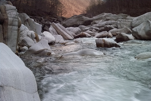
xpan_verzasca1108_03_03.jpg

The geography of Switzerland is dominated by the East-West high alpine ridges that split the country into Northern and Southern parts. The Northern part is where the major cities and industrial centres are located. The Alps themselves are the home of spectacular highlights like the Eiger, the Matterhorn, or the Aletsch Glacier. But the Southern side is a little less well known, and has a quite distinct character. South of the Rhone Valley and the Gotthard massif lies the Italian-speaking Canton of Ticino. And while Ticino certainly has it’s fair share of tall peaks, the highlights, geographically speaking, are to be found in and around a series of glacial valleys descending from the high snowfields, with tumbling rivers feeding into the Maggiore Lake. Any one of these valleys, including the Maggia, Calanca, and the Centovalli, would keep most landscape photographers busy for years, but the jewel in the crown, and the subject of this article, is the Valle Verzasca, through which the river of the same name runs.

The Verzasca valley is around 25km long, stretching due south down from the village of Sonogno, through an endless sequence of cascades, rapids and gullies until it reaches the artificial Lake Vogorno. This is created by a spectacular dam, the Diga di Contra, which was the scene for the opening sequence of the James Bond film Goldeneye, and today is famous for its terrifying bungee jump. Having passed the dam, the river threads its way in a more leisurely fashion before emptying into Lake Maggiore, a few km away from the city of Locarno.

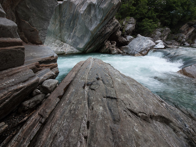
xpan_verzasca0412_05.jpg

I defy any landscape photographer with a pulse to get further than a third of the way up the valley without demanding to stop. Even if the temptations of the artificial lake can be resisted, with the clusters of old town houses clinging to one steep side, and the emerald green waters of the lake lapping up against the forests that plunge down to the other side, once you pass the church at Berzona (carefully!) and enter the upper valley, the scenes that unfold are irresistible.

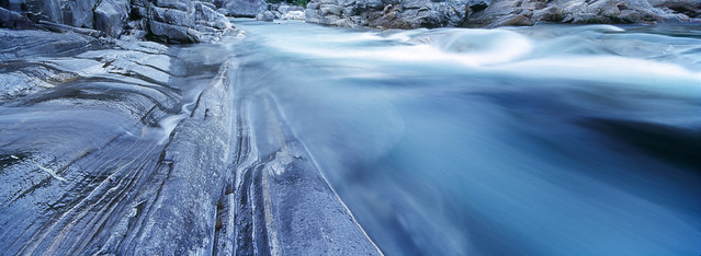
drm_dp2m_20140305_1411.jpg


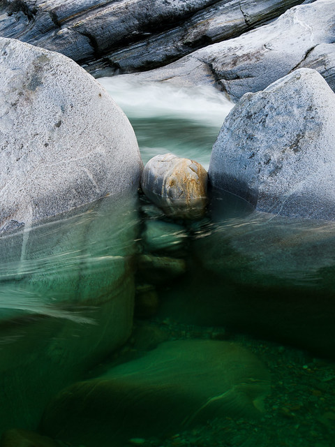
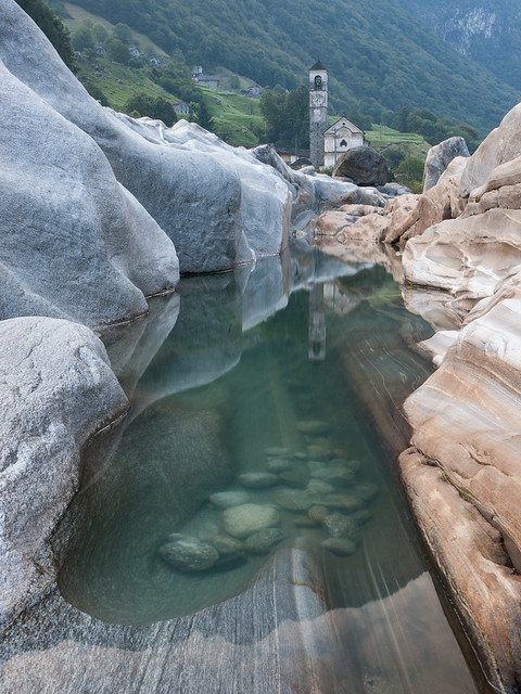
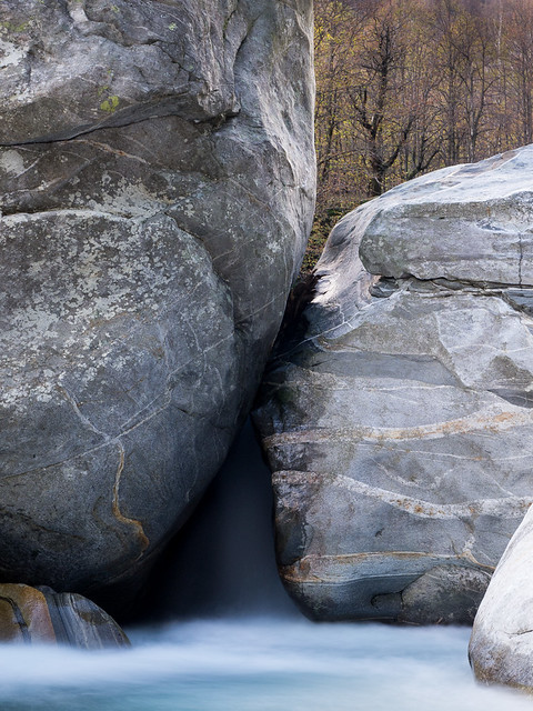
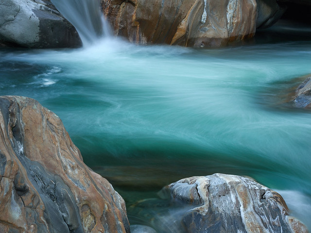
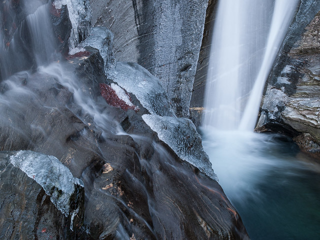
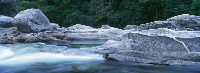
The bedrock of the Verzasca river is mainly gneiss, and over the millennia this has been eroded by the current to reveal fantastic banding and layering patterns in the rock, which in turn has been sculpted into spectacular forms. Add to this the transparent dark green and emerald waters, a sprinkling of reflected light from the surrounding forests, and any one location could keep you busy for a week. And there are countless such locations. I am fortunate enough to live close enough to the valley to visit pretty much on a whim, and have been doing so for 15 years, but even so, on each visit I discover somewhere or something new.

{@IPTC.Title}

The nature of the landscape suits it to a variety of styles, from wide angle vistas all the way down to very intimate details. For some reason, very little has turned up the way of photographic publications from the area, but one book I have found, Pietre in valle Verzasca, by Mario De Biasi, concentrates mainly on detail studies of small scale rock patterns and formations. You can embrace, or leave out, the water. You can feature the surrounding chestnut forests, especially in Autumn, or crop them out. You can pick a short stretch of the river and get to know how all the little details of the flow change with the seasons and the water level. The water level is very variable, and this often leads to certain compositions being quite unrepeatable.

xpan_verzasca1108_02_11.jpg

After Berzona the valley contracts very noticeably, and you start to get glimpses of the river. You can also see the village of Corippo, the smallest municipality in Switzerland, clinging precariously to the opposite slope. Corippo is well worth a visit: the whole village is protected as a Swiss Heritage Site, and remains largely untouched. It was not even accessible by road until the end of the 19th century.

Some of my favourite haunts are found soon after the Corippo crossroads. This part of the river is dynamic and fast moving, and it’s well worth taking a little time to discover paths down to the rocks. A word of warning, though, which applies to the whole valley: be very careful, the rocks are very slippery when wet, and are prone to accumulate black ice the winter. You do not want to fall into that river, even in the summer. It has very strong currents and is very cold. And, sadly, it claims victims every year. Take your time, don’t go down in the gorge alone, and don’t take unnecessary risks. The water level can also change frighteningly quickly, and it is all too easy to get trapped. Since Switzerland is not much of a nanny state, and assumes you can take care of yourself, you won’t find many handrails, but there are an increasing number of warning notices in the parking areas.

drm_20150826_P8263353.jpg

Up until now I’ve managed to completely avoid any mention of the number one attraction of the valley, the village of Lavertezzo. Let’s be clear, you’d probably be best advised to avoid Lavertezzo in the summer, unless of course your photography extends to a more Martin Parr-like style. Lavertezzo is totally gorgeous, but it is completely overrun in summer, even to the extent that large tour busses manage to get there (totally insane in my opinion, and I’ve seen some stuck in the narrow, tight hairpins at the mouth of the valley more than once). However, should you find it at a quiet moment, you’ll find it hard to ignore. The village itself is pretty, but the main attraction is the area just below it, where the river has cut channels of all shapes and sizes through a wide platform uplifted gneiss. Overlooking this is a high, narrow twin arched stone bridge dating from the 17th Century. I described Lavertezzo in a little more detail in an article I wrote back in 2009.

drm_2011_08_18__8184886.jpg

The human history of Valle Verzasca has, up until the mid–20th Century, been one largely of poverty and subsistence farming. Being a closed valley, it generally attracted less attention from invaders than surrounding regions, and was something of a safe haven. It came under the control, variously, of the Swiss Confederation and various Northern Italian kingdoms, but was always heavily under dominion of the Catholic church. It was also pretty much uninhabitable in the winter, and then the population moved down to the Magadino plain, along with their livestock. Some reminder of this is still evident in place names today, for example you will find the village of Lavertezzo Piano near the foot of the Verzasca, to where the population of Lavertezzo retreated from the snows.

drm_2012_11_02__B021076.jpg

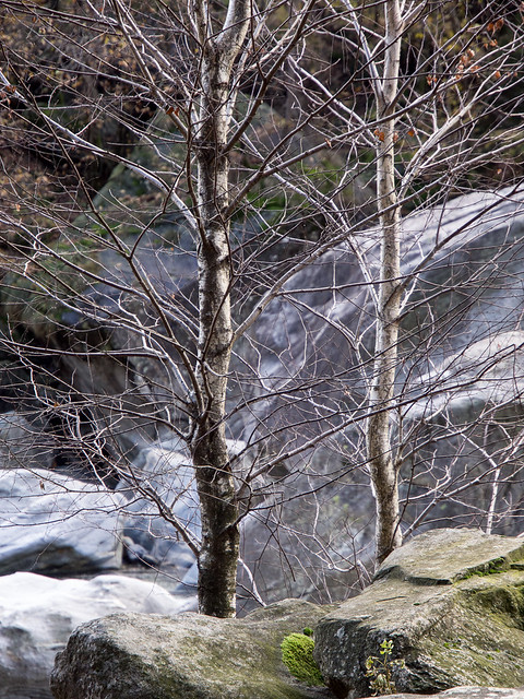
The forests surrounding the valley have a large proportion of chestnut trees. These were actually planted in the Middle Ages, and provided a critical contribution to the people’s diet. Chestnut flour is still a treasured traditional ingredient in Ticino. However, a blight leading to failed crops bought famine in the late 19th century, leading to mass immigration from the valley, and other surrounding areas, to North and South America, and to Australia. The museum at Sonogno, as well as the one at Cevio in Vallemaggia, document this period. The result was a massive crash in the population, which was far higher than today. If you follow the mountain paths from any of the villages, you quite often come across the ruins of long-abandoned hamlets invaded by the forests. It can be quite moving to sit and imagine the lives of the long-gone inhabitants of these forgotten villages. And of course, there lies another whole world of photographic opportunity.

drm_2012_11_02__B021108.jpg

Upstream of Lavertezzo the river widens, and rushes over a series of rapids. This area is more interesting for the colours of the larch forests in Autumn, and for a number of quite spectacular waterfalls on the west side of the valley. But the next part is perhaps the richest of all from a photographic perspective. Below the village of Brione, the river drops about 50m over a couple of kilometres, threading its way through a field of huge boulders. You see the end of this stretch where the road crosses the river, about 5km from Lavertezzo. The east bank of this stretch is accessible from a footpath which runs from the bridge all the way up to Brione. Getting to the river itself, or to the west bank, requires a bit of dedicated scrambling, but it’s well worth it. It would take a decade to run out of opportunities here.

drm_2015-08-19_P8193304

From Brione itself a quiet side valley heads off to the west, the Val d’Osura. This has a quite different character, with the river sluicing over wide limestone shelves. It’s an easy hike up the narrow, largely car-free road, and well worth a detour. The main valley continues up to the village of Sonogno, where it splits. This is also the end of the road for cars, and for the Post Bus. Both branches of the valley are worth exploring, but my favourite is the westerly one, known as Val Retorta, which has many more landscape marvels to offer, and leads eventually to Püscen Negro, the highest village in the valley, now abandoned and never connected to the outside world.

{@IPTC.Title}

In summary, if you’re looking for a location which can offer both boundless photographic potential, and also plenty to entertain non-photographer members of the family, this is it. But be warned, you won’t want to leave.

 

Posted in essay on Tuesday, January 12, 2016 at 09:03 PM • PermalinkComments (6)

Return to Damoy

the ghost of Basil Doumer

in Antarctica , Sunday, February 03, 2013

On January 21st, 2013, I returned to Damoy hut, on Doumer Island, having left on January 2nd, 1988. I first arrived there on December 5th, 1987, with about 20 British Antarctic Survey colleagues, expecting to be there a few days, before being flown further south to Rothera. As it turned out, things didn’t work out quite as planned, resulting in myself, Clem Collins and Alan Osbourne not only being the 2nd ever party to spend Christmas at Damoy, but smashing all records by being the first to spend New Year there. So it figures quite strongly in my memories of Antarctica.

Damoy hut 1987

Damoy Hut, 1987

So, a few weeks ago, thanks to Graham Charles, the OneOcean expedition leader on the Akademik Vavilov, I was dropped off, together with Luchiana, at Damoy point, and we trekked up and over the point to the hut, about 1km away. As far as I remember there was considerably more snow back in 1988… The hut itself has for some reason been repainted a sort of turquoise colour, rather than the pink hue it used to have. And the penguin weather vane has gone.

Damoy door

Welcome home. We’ve been expecting you

Inside the hut very little had changed. On opening the door it felt just like I’d never been away. Apart from a few notices on the wall placed by the British Antarctic Heritage Trust, pretty much everything was exactly as it was. Even the smell was the same. Inside the bunk room, the only thing missing apart from my sleeping bag was the radio. Three pairs of the original snowshoes, without which it was very difficult to get around outside, are still there. Actually it was only marginally easier getting around with them on: snowshoe design has improved somewhat over the years.

Drm 2013 01 21 drm 20130121 5350

Proper snowshoes - they make you fall flat on your face every 3 steps

One thing had changed, which I knew about, but had forgotten - the group photo we took on Christmas Day 1987 was on the wall.

Drm 2013 01 21 drm 20130121 5346

Christmas 1987

Digging out my notes on my enforced holiday at Damoy confirms that although it is a beautiful spot, I was increasingly frustrated, and bored, by being stuck there. It would probably be something like paradise now, with a generator and a digital camera, but back then I wasn’t really that in to photography, and I was supposed to be a further 15 degrees south. And we were running very low on paraffin, meaning that in the last couple of weeks we could not use the heater. And Alan, Clem and myself were not the most compatible trio you could pick. The weather was usually foul, and when it wasn’t, it was either foul at Rothera, or the aircraft were busy somewhere else. With the skiway snow warming up and deteriorating, It looked increasingly like we were going to have to be evacuated by ship. Finally, we were rescued by a Twin Otter piloted by my field party pilot Mike Collins, with the new BAS director David Drewery along for the ride (everybody at Rothera disliked Drewery, and gave him the cold shoulder. I felt sorry for him, and tried to get him involved in planning my field work, as it was in an area he’d been involved in. This did not prevent him stabbing me in the back a short while later, thereby demonstrating what a good judge of character I am).

Back to the present day, it is remarkable how well preserved the hut is. Even to the extent of tins of the despised “Nespray” still being on the shelf. Actually there’s probably a hidden dump of Nespray tins outside somewhere. The various “Use Before Feb 1968” ingredients we used to cobble together some form of Christmas baking are still around too.

Drm 2013 01 21 drm 20130121 5369

There’s never a shortage of Nespray…

Drm 2013 01 21 drm 20130121 5355

All that the creative cook requires

I didn’t want to make Sophie, our zodiac driver, wait too long, and conscious of the fact that we’d been out of sight of any of the expedition staff for over an hour, I felt it was time to close and bolt the door one last time, and make our way back to the Point. On the way I couldn’t but help stopping a few times at the various Gentoo rookeries on the way. But none of the penguins seemed to remember me.

Back on 23rd December 1987, the nearby (but inaccessible to us) Port Lockroy was visited by the cruise ship m/v World Discoverer, as I mentioned somewhat inaccurately in an earlier post. There were very few tourist ships around in those days - nowadays there would be one almost every day - and this was our only visitor. Quoting from my notes:

23rd December, Damoy: Well, we’re _still_ here, but at least today was exciting! The tourist ship “World Discoverer” passed through Neumayer Channel, answered our call and invited us on board for an evening barbecue! As they had anchored in Port Lockroy, they kindly sent a zodiac around for us. We were well looked after by both the crew and the passengers, the passengers being mostly Americans. Before I got totally inebriated I gave the assembled masses a talk on BAS activities, using a familiar AKG microphone. Biggest audience and best applause I’ve ever got though! Anyway, we then passed on to the food, which was exquisite after 3 weeks of munch, and the mulled wine. This was probably my biggest mistake, but when you’ve been doing sod-all in the middle of nowhere for 3 weeks, you don’t pass up the offer of refill after refill from a rather nice young German girl. (…) We finally returned to Damoy with crates of Guinness,  Budweiser and Carlsberg, 2 bottles of Port and a bottle of Bacardi, not to mention steaks and fresh vegetables.

Later in the evening I felt rather unwell.

On returning to the Akademik Vavilvov, after, finally, after all these years actually making it to Port Lockroy, the when turned full circle as Graham invited me up during the recap to give a brief account of the day’s adventures. Little did I imagine this scenario just over 25 years ago.

Luc 20130121 5342

Hogging the spotlight once again

I’d like to effusively thank Graham Charles for this opportunity, and for trusting me not to get lost or do anything stupid. And equally a big “thank you” to Sophie Ballagh for driving the Zodiac and patiently waiting for our return. It was quite an experience…

Damoy table 87

Inside the hut, 1987

Damoy table 2012

Inside the hut, 2013 - photo by Luchiana Cinghita

Damoy stove 87

Damoy stove, 1987

Damoy stove 2012

Damoy stove, 2013 - photo by Luchiana Cinghita

Damoy bunk

Somebody’s stolen my sleeping bag! - photo by Luchiana Cinghita

Drm 2013 01 21 drm 20130121 5349

And not forgetting the legendary epic explorer Sir Basil Doumer of Damoy


Posted in Antarctica | essay on Sunday, February 03, 2013 at 06:41 PM • PermalinkComments (2)

Volcano hopping in the Aeolian Islands

shooting volcanos

in essay , Wednesday, October 05, 2011

The Aeolian Islands form an archipelago of seven volcanic peaks poking above the sea to the north of Sicily and the  Messina Straits. Of those seven, one, Stromboli, is active, and has been in constant (“strombolic”) eruption for  at least 2000 years. Another, Vulcano (the name is a bit of a giveaway), is a smouldering stratovolcano which last blew its top about 100 years ago, and must be thinking about a repeat act in the not too distant future, based on its past record.  Lipari, the largest island, is classified as active by geologists, and has some low key fumarole activity scattered around. The rest are dormant or extinct. Salina, with it’s distinctive twin peaks, is the second largest, and fairly busy by Eolian standards (i.e sleepy). Panarea is a small, discrete high end tourist resort, with the relicts of a massive explosion, Basiluzzo, featuring active undersea vents, a kilometer or so offshore. Filicudi and Aliculdi are car-free, timeless, sleepy dreamlands which you’d love or loathe. All seven are linked by a web of hydrofoils and ferries. If you ever happen to have read Christopher Priest’s novel “The Affirmation”, or his “Dream Archipelago” short stories, this could well be the setting for them.

Drm 090521 161916

Lipari, and Salina’s twin peaks, from the rim of Vulcano’s crater.

The Dream Archipelago

I have always been vaguely aware of the Aeolian Islands. They seemed to be a distant, mythical, far off place which was hard to get to, and about which little was said. I just knew I wanted to go, and finally at the tail end of a two week  vacation in eastern Sicily (also highly recommended, especially Etna), I had my first opportunity. Three days in Lipari, a quick glimpse of Stromboli, an afternoon on Salina and a hint of Vulcano and I was hooked. The next trip  was exclusively to the islands, included cameras, and a first ascent of Stromboli.  The second, earlier this year,  was exclusively photographic, out of season, and featured Vulcano and Stromboli, and some serious near-vertical trekking.

Drm 090523 083818

Alicudi and Filicudi, spied from Lipari.

Vulcano and Stromboli are the obvious attention grabbers, especially Stromboli, so for now I’ll concentrate on these. I’m really at a loss to say which fascinates me the most. Stromboli is more spectacular, more isolated,  more wild and, I guess, more romantic. Ingrid Bergman certainly thought so. Vulcano is more accessible, has fewer  restrictions, is pretty spectacular itself, although you need to seek it out a bit more, and from a photographic  perspective arguably has more potential. I’d hate to have to choose between them.

Drm 2011 03 27 3274206

The volcano looms over the church of San Vincenzo on Stromboli.

Vulcano

Vulcano’s main feature is the Grand Crater. It is truly impressive, about a km in diameter, with the rim between 400 and 600m above sea level. The north west side is riddled with fumaroles, of varying activity, and wide  deposits of sulfur and other minerals. The crater itself is sprinkled with large lumps of obsidian, which you  really would not want falling on your head.

Drm 2011 03 24 3243773

Sunrise through sulphuric fumes, Vulcano.

The contrast between the bright yellow sulfur, the deep blue  Mediterranean sea, and the equally blue sky, is full of potential but not so easy to exploit well. Especially when  the pretty yellow patches are associated with enthusiastically poisonous fumes emanating from the fumaroles and  tending to creep up behind you when you least expect them. Please note: if you do visit Vulcano, don’t let the relaxed attitude to public safety put you off. In a nanny state like the UK these would be seriously fenced off. They can be lethal, and stumbling around a steep rocky smoke breathing toxic fumes is not a fun way to spend your time. But then again, with care and attention to your getaway route, you can get extremely close. Of course, then  you’ve got to watch out for boiling water and scalding steam. Hey, it’s a volcano!

Xpan vulcano11 3 07

Obsidian and sulphur, Vulcano.

The climb up to the crater is quite straightforward, but don’t carry too much gear, and do carry as much water as  you can carry, and a snack. There’s no bar or gift shop up there!  If you’re taking photographs, honestly you want  to go for the sunrise or sunset slot. Sunrise is better (clearer air) but sunset can be spectacular.  To get to  the path, just follow the road south out of the port, skirting the crater. About 2km from the dock you will see a  path to your left.  Don’t even think about shortcuts, the path is the only safe way, and any shortcut is going to  be much harder.  The path zigzags up the side of the crater. At the first hairpin, a recently installed feature is  a kiosk where you might be asked to pay 2€ for entrance. This is not a con, but an official move to raise funds to  protect the area and improve access. The results can already be seen in a much improved upper section of the  path, which previously could be quite tricky.  However, the kiosk tends not to be manned at 5am ...  Initially the  path is pretty steep. Take your time, plod along. It’s not as bad as it seems and all will be forgiven when you  get your first glimpse of the crater.

Drm 2011 03 23 3233668

The Grand Crater, Vulcano.

And it will get you prepared for Stromboli! Stromboli is a different kettle of fish. The crater zone is  approximately 1000m above sea level, which is where you’ll be starting from (sea level, give or take 50m).

No pain, no gain

The  climb is steep, unrelenting, frequently exposed to the Mediterranean sun, and as you get higher you’ll be walking  on volcanic sand and ash. It takes between 2.5 to 3.5 hours, depending on the conditions and the group. Because  you’ll have to go in a group. Health & safety regulations introduced some years back in reaction to several  accidents as well as increasing volcanic activity now dictate that you must go with a recognised and licensed  mountain guide, who will always have at least one assistant, and stays in constant communication with the emergency services. Most guides are local, multilingual (at least to some extent), and have extensive knowledge of aspect or the other of the island and volcano, be it geology, vulcanology or botany. Several are qualified scientists. So there is no rip-off here, the guides are well organised and responsible, and the charges are quite  reasonable (around €20). But there is a supply and demand problem. In-season (basically Easter to August), demand  is very high, and groups are large and constrained. In theory each group should spend no more than 30 minutes on  the summit ridge (not including a rest at the lower platform, at about 850m).  This is in part a restriction for  safety reasons, to minimise exposure to toxic gasses (including carbon monoxide), and in part a limitation to  allow the maximum number of visitors per day (and all groups aim to be there or thereabouts at sunset). After  such a climb, it can feel pretty disappointing to have so little time at the summit, so try to go out of season.  Rules are more easily bent, the atmosphere is more relaxed, and 90 minutes on the ridge is not unheard of - by  which time it’s dark anyway.

Drm 2011 03 25 3253979

Smoking vents, seen from the lower platform, Stromboli

Shooting a volcano

So, photography. Well, really, don’t take too much gear. Really, if you’re exhausted when you reach the top,  you’ll be in no shape to take good photos, especially as you’re going to have to act and react quickly.  First of  all, if you’re in a large group, try to be at the front for the final stretch. You’re going to want a front row  view. Second, or actually no, first of all: safety first. This is a dangerous place. One slip, and you’re quite  literally toast. Nobody is going to go down into to the rift to rescue you. No photo is worth that. Do take a  tripod. Forget filters, you don’t need them, and you’ve got no time to fiddle with them, with the exception of a  UV / Skylight to protect the lens from ash and dust ... which quite possibly will be raining down on you. That’s  why the guide gave you a helmet. Put it on. I would recommend a mid-range zoom lens, with a 35mm equivalent of  around 70-200mm. Take a wider angle if you feel you can take the weight (but honestly, there are few worst places  to change a lens), but you probably won’t use it. I’ve taken an XPan up twice and got almost nothing worthwhile. A  remote cable release is good to have as well.  Observe first: try to avoid seeing the world through your  viewfinder. The experience of being 500m away from an erupting volcano is literally awesome, and pretty much unique at least in Europe.  Identify a good candidate for photos, usually a crater which is producing eruptions  every few minutes or so, frame your shot, set up your exposure, check your histogram, and focus manually. Set up  your motor drive (actually, set up as much as you can before the climb). Then hold your cable release, enjoy the vista, and wait for the opportunity. If you hold your nerve, you’re in with a good chance to get a great shot. If you just flap around reacting to the volcano rather than observing and waiting, you’ll end up with a lot of  blurred shots with something that might be lava in the corner. It’s really not dissimilar to shooting fireworks.  Planning and anticipation are key.

Drm 2011 03 25 3254015

Third time lucky ? It took 3 visits to Stromboli before I caught this!

Drm 2011 03 27 3274267

The show just keeps going on.

Then sooner than you want it’s time to go down, but actually this is almost as much fun. You won’t go down by the steep path you came up on, but rather by a wild, head-torch illuminated semi-controlled slide down and across the relict ash slope on the south side of the volcano. You’ll take about 45 minutes to reach the village. And you’ll want several beers to go with that well-earned pizza.

And now ... the easy way up

If you feel like a (relatively) more relaxed and less constrained experience, alternatively you can walk  out towards to east of the island, past Piscinas, past the Punto Labronzo lighthouse, and follow the old path up the ridge overlooking the “Sciara del Fuoco”. You are allowed to climb up to 450m without a guide, and you can get as far up as a  platform which povides great views of eruption craters along the top of the ridge, as well as (if you’re lucky) lava flowing down the slope, and ejecta crashing into the sea below. It’s a different experience, but equally rewarding.

Drm 2011 03 26 3264062

Overlooking the Sciara del Fuoco, Stromboli.

And there’s a lot more to the Eolian Islands than Volcanos. The best time to visit, in my experience, is late  March, but it varies a bit year to year. At that time things are pretty quiet, the tourist infrastructure hasn’t really got going, and finding a guide is not 100% guaranteed ... but just relax. It’s all part of the experience.

Drm 090522 175428

Not just volcanoes. A natural arch on Lipari’s west coast.

Getting there

The most reliable, year-round link is by hydrofoil from Milazzo. Both Ustica Lines and Siremar operate regular  services. Departures to the outer islands, including Stromboli, are much less frequent out of season. Milazzo is reachable from Catania airport, by a combination of public transport (entertaining but slow), or by taxi service  (fast but more expensive). In-season some bus services link both Catania and Palermo airports with Milazzo.

Stromboli Guides

Both Magmatrek and Antonio Famularo are highly recommended and very professional. Out of season they provide a joint service.

Xpan stromboli11 3 03

It’s not all hard work…


Posted in essay | Travel on Wednesday, October 05, 2011 at 09:27 PM • PermalinkComments ()

Photography in Ticino: Lavertezzo

Some notes for photographers

in essay , Thursday, July 23, 2009

This is the first of what I hope will be a series of articles on recommended photographic locations in my adopted home, the Italian-speaking Swiss canton of Ticino (sometimes referred to in English by it’s German & French name, Tessin).

I’m going to start with a sitting target: a location which is very easy to get to, and has enough photographic potential to fill a book (which it already has). Lavertezzo is a village in the Verzasca valley, and a popular tourist spot. It is known for the double arched 17th century stone bridge (Ponte dei Salti) which spans the river. But it is mainly what lies under the bridge which interests photographers.

drm_061217_151712.jpg

The river has carved and polished a fantastic landscape of complex, wildly patterned and multicoloured stone sculptures, and the river’s startlingly green glacial water alternately pools and rushes through clefts and over falls. It is an ever-changing scene, which rewards return visits and never fails to deliver something new to the observant eye.

drm_041006_153506.jpg

But it is tricky to photograph. First of all, at least in summer, other people are a major problem. You need to arrive by about 7am, and you can pretty much forget photography after 9am - although you can wander up and down the 25km or so of the valley’s length and find plenty of more secluded spots. The next problem is the light. The rocks tend to be highly reflective, and contrast is a major problem. The harsh overhead sunlight of a Ticino summer makes photography at any other than snapshot level pretty complicated during most of the day… unless, of course, you turn a problem into an advantage and shoot infrared. Unfortunately you’ll probably also need to shoot the tourists.  Out of season, it isn’t so tricky. In autumn or spring you can arrive at around 10am, and have the place pretty much to yourself.  In winter, you can arrive pretty much any time you want - snow permitting - and be guaranteed to be on your own, although the bridge may be roped off.

drm_061217_154506.jpg

What to take

A polariser is a must, to bring out the deep emerald green of the water, and a couple of neutral density filters would be useful. You can find subjects pretty much at all focal ranges, although my personal preference tends to be to focus on details using medium to long focal lengths. A tripod is strongly recommended as you will usually want to take fairly long exposures.

Clothing and footwear

It is extremely important to wear good shoes with plenty of grip. Watch out for wet patches on the rocks - they can be very slippery, and you do NOT want to fall into this river. In winter be very cautious and look out for ice. Otherwise, summer temperatures tend towards to low to mid 20s (Centigrade, obviously) and in winter are usually close to or up to 10 degrees below freezing.

drm_090723_065648.jpg

How to get there

It’s easy: the Versazca river flows into the northern end of Lake Maggiore, near Tenero, a few km north of Locarno. The valley road starts in the centre of the village of Gordola, easily reached from the main Locarno - Bellinzona road. The valley road is clearly signposted “Valle Verzasca”. The road climbs quickly with many twists and turns, until it reaches the foot of the Versazca dam (of James Bond fame), then goes through a series of twisty tunnels until it straightens up (relatively speaking) above the dam. Just carry on for about 10km until you reach Lavertezzo. There is a bus service from Locarno which serves the whole valley. The first bus may just arrive early enough for you to get some photography done, but it is better in this case to drive.

Lavertezzo on Google Maps

Read more about Lavertezzo at MySwitzerland.com.

Posted in essay | Photography in Ticino on Thursday, July 23, 2009 at 06:33 PM • PermalinkComments (1)

An accidental photgrapher in Antarctica (revisited)

A slightly revised article written quite a while ago, rescued from the old site.

in essay , Tuesday, February 10, 2009

Sometime shortly after Noah’s Ark ran aground, in early 1984 I was working in my first job in Cranfield, England. Whilst it was more or less related to my university education, it wasn’t very exciting. One day, I picked up a copy of New Scientist at lunchtime, and found a job advertised for a “radio echo sounding research assistant” at the British Antarctic Survey (BAS) in nearby Cambridge. The pay was peanuts, but it sounded interesting, so I applied. And to my surprise I got the job. I had never really thought about Antarctica. Several of my friends at University had desperately wanted to join BAS, with no success. And I just sort of stumbled in. Some time later I remembered that when I was around 10 I went through a phase of reading books about epic polar explorers, but I had completely forgotten this. So there it was - a defining moment in many ways, as it turned out.

Canon lens cap embedded in the Ronne Ice Shelf, circa February 1988

I visited Antarctica twice, once in 1987/88 with BAS, once in 1991/92 with the Norwegian-led Aurora Programme, under a European Space Agency research activity. I have to say that BAS, certainly at that time, was very British. No women, stiff upper lip, yes sir, no sir, three bags full sir. With my ever characteristic inability to respect blind authority, coupled with some very frustrating work circumstances, I ended up pretty unpopular with some of the hierarchy. To be fair, the hierarchy had a point, to some extent, but it was significant that several other people had similar issues and none of them were British. The Norwegian “total chaos” approach was far better suited to my character, and my professional output was far better in those circumstances.

Rocky ridge emerging from the ice, towering over Damoy Hut (the dot in the snow, left side)

The accidental path that led me to Antarctica was mirrored by my equal innocence about photography. BAS in the late 1980s was (and almost certainly still is) as much a camera club as a science lab. Everybody was a camera nut, and coffee break discussions were as likely to be Canon v. Nikon as the latest discoveries in polar science. Naturally there was the odd Minolta and Leica fan around too - not to mention a small but vociferous Olympus OM clique. Everybody was filling up every spare space in equipment cases with film stashes. Eventually I realised I ought to get involved in all this, and I started to panic. What on earth were all these numbers about ? F-stops ? Shutter speeds, manual, spot, apertures ? I had no idea, and certain friends (hi, Rick) were beginning to get annoyed with me. I “borrowed” my father’s camera and lenses, which turned out to have “Canon” written on them. Another accidental choice that defined my choice of equipment for many years forward. So I had a Canon FT QL, and a handful of lenses, including a Canon 50mm f1.4, a Vivitar 200mm zoom, and what I now know was a grotesque fish eye adaptor but at the time I thought was pretty cool. The camera expired some years ago, from terminal neglect, but the lenses are still around. Even the fisheye.

Mountains above Port Lockroy, through the grotesque fisheye adaptor

I have approximately 3000 slides from Antarctica, mostly Kodachrome 64, with some K25 and some Ektachrome, because it seemed the right thing to do. Of the 3000, maybe 30 or so are reasonable photos, and of these, approximately 10 have survived being carelessly stored over the last 15 years. Only around the late 90s, when I got my first film scanner, did I wake up to the scourge of slide emulsion fungus. Of course in “travelogue” terms, there are a lot more than 30 interesting slides, and as far a personal mementoes are concerned they’re almost all interesting. Such is the level of interest in Antarctica that I was frequently asked to present slide shows. It was from conversations arising from these that I ended deciding to write this article.

Worried penguin, Rothera Base. Antarctica is a land of high contrasts.

Photography in Antarctica is technically tricky. Landscapes are often highly contrasted between the white of the snow, the dark rocks, the water and the sky. The wildlife is contrasty too - penguins are black and white, pretty much. In the vast expanses of the great ice shelves, the world is two colours: blue and white. To cope with all this I had the built in selenium cell centre weighted meter of the Canon FT, where I had to line up a needle with a circle. I’m pretty sure I didn’t really grasp why I had to do this - never mind understood that the camera thought snow was a neutral gray! Given this it is remarkable that anything worked. Certainly various people gave me tips on exposure at various times, but at the same time it does illustrate that you can sometimes get by blissfully ignorant of the “rules” and mechanics.

In many, if not most of my photographs, especially those taken in the interior, the weather is not very good. This isn’t because the weather is very bad in Antarctica - simply that when you’re there to work, a good weather day is a work day. Photography days are bad weather days. Since bad weather often translates to interesting conditions for photography, this is not always a drawback. But once again, I didn’t know that at the time!

The traditional way of getting to Antarctica is by sea. Certainly in the mid-80s it was the only realistic way of getting to the Antarctic Peninsula. This meant crossing the Drake Passage, which can be a fearsome experience. In fact, in 1987, due to various circumstances, I left from Port Stanley in the Falklands, crossed the Drake Passage to the South Orkney Islands, crossed back to Port Stanley, and then finally back again to Deception Island and the Peninsula.

Sea ice inside the Deception Island caldera

This is more or less the itinerary taken by tourist ships (although without the doubling back!). Further travel in 87/88 was by aircraft, a Twin Otter fitted with skis. In 91/92, the route was far less travelled, going from Monetvideo in Uruguay non-stop to the south Weddell Sea. This was more or less the route travelled by Shackleton’s Endurance, and we were perhaps fortunate not to suffer the same fate. All this travelling gave plenty of opportunity for photography.

Iceberg off the coast of Graham Land

The potential for landscape photography is endless along the Peninsula and in the South Atlantic islands. On the Weddell Sea coast, which is fringed by ice caps and ice shelves, there is little other than snow, ice and water. The weather along the Peninsula is frequently bad, but can sometimes clear to an absolutely breathtaking clarity. To take advantage of this, you need to be in the right place at the right time. In 1987, I was “stuck” for 6 weeks at one of the most photogenic places in Antarctica. Wiencke Island is home to vast numbers of Gentoo penguins, and is surrounded by awesome scenery.

On the beach, Wiencke Island.

Mt Français, the highest mountain in the Peninsula, towers over the Neumayer Channel. The historic base of Port Lockroy was in sight but frustratingly out of reach. All this just outside the front door. That I managed a few reasonable photos was more by luck than judgement… Most of my slides are affected by dreadful vignetting, and blur due to the lack of any tripod or technique. It is tempting to say it was a wasted opportunity, but since I wasn’t really aware that I was interested in photography in those days, it isn’t really true.

Mt Français, on Anvers Island, across the Neumayer Channel

As I said before, a lot of the interior of Antarctica is less photogenic. It is none the less fascinating, and some unique sights are to be found. But the overall impression in the middle of one of the great ice shelves, on a good weather day at least, is of White, Blue, and total stillness and silence.

Sea ice-filled rift on the Ronne Ice Shelf. The ice shelf here is about 500m thick. It’s floating.

Penguins: the number 1 association in most peoples minds with Antarctica. And polar bears of course. Antarctica can be a paradise for wildlife photographers. Wildlife is plentiful, at least in coastal zones, fascinating, and approachable. Apart from penguins of all shapes and forms, there are various varieties of seals - Weddell, Leopard, Fur, Elephant, the last three which can be seen at close quarters on land (although not too close - “approachable” does NOT mean “friendly”. These animals bite, big time). Birds are everywhere, from the huge and fascinating wandering alabatross to the tiny and perhaps even more fascinating Wilson’s petrel. Not to mention that airborne menace, the brown skua.

Weddell Sea on sea ice near the Brunt Ice Shelf

The best place to see a lot of this wildlife on the “tourist trail” is actually South Georgia. Although it is included in many tourist ship iteneraries of Antarctica, this usually involves a quick stopover at Grytviken. South Georgia is worth much more than this. One day, maybe… A wonderful account of South Georgia is given by Tim an Pauline Carr, in their book Antarctic Oasis. Pedants would argue that it isn’t in the Antarctic, but whatever.

Fur seal pup, near Grytviken, South Georgia

So, penguins. I know that’s what you’re here for. Everybody ends up with their favourite penguin variety. Mine is the Gentoo, with the Adelie a close second. Gentoos are plentiful in the Antarctic Peninsula, so these, along with King Penguins, are the ones most likely to be seen. Gentoos are quite small but very endearing. They have the classic penguin shape, a red beak, and a white flash above their eyes.

Gentoo penguin, Wiencke Island.

Note that the photo above was taken with a 50mm lens. You can get as close as you want to penguins on land, as they have no land-borne natural predators - just seals in the water and skuas in the air. This does not, however, mean that they will not be worried or stressed, simply that they have no “run away” mechanism gentically programmed in this case. The Antarctic Treaty lays down strict regulations on wildlife protection, and at least at BAS any violation of this was a serious disciplinary offence. I believe most responsible tourism companies follow these guidelines. Antarctic wildlife (actually, pretty much all wildlife) has a hard enough time without humans making it worse.

The local immigration officials turn up for an inspection

Having said this, it is impossible to not get involved with Adelie penguins. These characters, generally found further south than Gentoos, are irrepressibly inquisitive. They come into buildings, into tents, anywhere. They are vastly entertaining, but can end up a bit annoying after a while.

The star act of the penguin world is the Emperor. These birds are about 1.3m tall, and are the only variety to spend the winter in Antarctica. I’m tempted to say “stupid enough to”, because compared with Adelies they don’t seem too bright, at least on land, but when you see them swimming underwater, it all makes sense. Emperors are the fastest swimmers, the deepest divers, and really one of the most remarkable species on the planet.

Emperor penguins on sea ice, Prinz Luipolt Coast.

Recommendations for visiting Antarctica

Finally, a few tips for people who want to visit Antarctica. If you can, get a job there: it’s much cheaper. Tourist travel is offered by many companies, using purpose designed cruise ships such as MV World Discoverer (for the very rich), slightly updated Russian research vessels, such as Akademik Shokalskiy, which are built to last (for the slightly less rich), and a variety of specialist operators (for the slightly crazy and rich). The Russian and associated variety are often the best bet: they are better in sea ice, and can get further south. However, one thing to bear in mind, especially in the Drake Passage, is that icebreakers are NOT optimised for stability in stormy seas. Stay in your bunk and close your eyes. Try to find a tour that concentrates on the Peninsula. Find a ship that goes through Lemaire Channel (aka “Kodak Crack”, although I guess these days it should be “Megapixel Maw”). The sub-Antarctic islands are nice enough, but be warned, they involve long, boring sea passages, and are generally on the itinerary because they are easier to get to. If you want to see Emperor penguins, you’ll have to go up a notch and find a specialist operator such as Adventure Network International. You’ll need to be Bill Gates though.

So do I agree with Antarctic tourism? Well it is a controversial subject, but on the whole, yes. Whilst tourism increases the risk of a major environmental disaster, the more people who get the chance to see these regions, the greater the pressure will be on politicians to protect them. Responsible tourism advocated by bodies such as IAATO seems ok to me. Antarctica is often called a “continent for Science”, but, finally, it’s much, much more than that.

Credits: a big thank you to Rick Frolich for all the advice those many years ago, to Julian Paren for telling me which way to point the camera, to Mike Collins for the laughs, and to Chris Doake for giving me the job in the first place and for encouragement and support thereafter. And, much later, to Michael Reichmann and Daniel Bergmann for showing me the value of the “crop” tool.

Posted in essay | Photography | Travel on Tuesday, February 10, 2009 at 10:41 PM • PermalinkComments (3)
Page 1 of 2 pages  1 2 >